Lakkos tou Mygerou - Vouloumenou (Kreta / Crete)
Izhodišče: Lakkos tou Mygerou (1570 m)
| Širina/Dolžina: | 35,24150°N 24,77806°E |
| |
Čas hoje: 2 h 30 min
Zahtevnost: lahka označena pot, lahka neoznačena steza
Višinska razlika: 697 m
Višinska razlika po poti: 740 m
Zemljevid: Anavasi 11.14
Priporočena oprema (poletje):
Priporočena oprema (zima):
Ogledov: 133
 | 1 osebi je objava všeč |
Dostop do izhodišča:
Izhodišče na grškem otoku Kreta se nahaja nad vasjo Livadia (tudi Livadya; gr. Λιβάδια; poštna št. 74051) pri koči Lakkos tou Mygerou (gr. Λάκκος του Μυγερού) na 1550 m nadmorske višine.
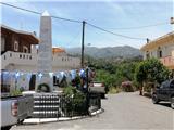
Odcep iz vasi Livadia je označen in se nahaja na manjšem trgu s spomenikom (gl. sliko). Od vasi do koče je 13 km asfaltirane ceste z mestoma strmimi ovinki, ki pa je v dobrem stanju in dovolj široka za srečevanje avtomobilov. Na cesti sledimo oznakam za Psiloritis v grščini "Ψηλορείτης".
Opis poti:
Nekaj korakov od parkirišča se desno proti pobočju odcepi pot, tlakovana s ploščatimi kamni iz okolice. Na teh kamnih se nabira pesek, ki pri povratku lahko povzroči zdrs.
Približno dve tretjini poti do sedla je pot tlakovana, nad višino 2000 metrov pa se preobrazi v klasično planinsko pot. Na 2250 metrih, po dveh urah hoje, se ta pot združi s tisto, ki prihaja iz izhodišča Nida (ogromna kotanjasta ravnica na vzhodu).
Od tu naprej ne sledimo več glavni poti, ki vodi proti zahodu na najvišji vrh Psiloritis, temveč se obrnemo proti vzhodu. Mestoma je pot težje vidna, pri čemer je zlasti potrebno paziti, da se ne zaide po poti, ki teče navzdol. Zato se je najbolje držati nekoliko levo po stezah planotastega sveta proti vrhu, ki ga dosežemo po 20 do 30 minutah hoje od sedla.
Slike:
 1
1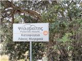 2
2 3
3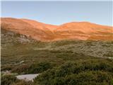 4
4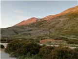 5
5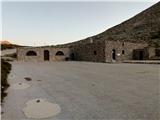 6
6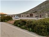 7
7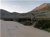 8
8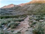 9
9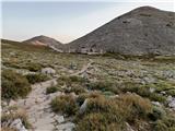 10
10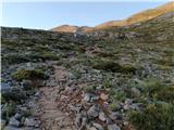 11
11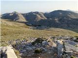 12
12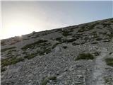 13
13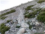 14
14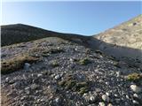 15
15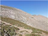 16
16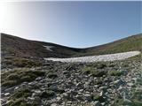 17
17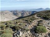 18
18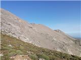 19
19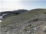 20
20 21
21 22
22 23
23 24
24 25
25 26
26 27
27 28
28 29
29 30
30 31
31 32
32 33
33 34
34 35
35 36
36 37
37 38
38 39
39 40
40 41
41 42
42
Diskusija o izletu Lakkos tou Mygerou - Vouloumenou (Kreta / Crete)
Za objavo komentarja se morate prijaviti:
V kolikor še nimate uporabniškega imena se morate najprej
registrirati.